To access these data, click on the DOI: 10.7924/G8RN35S6
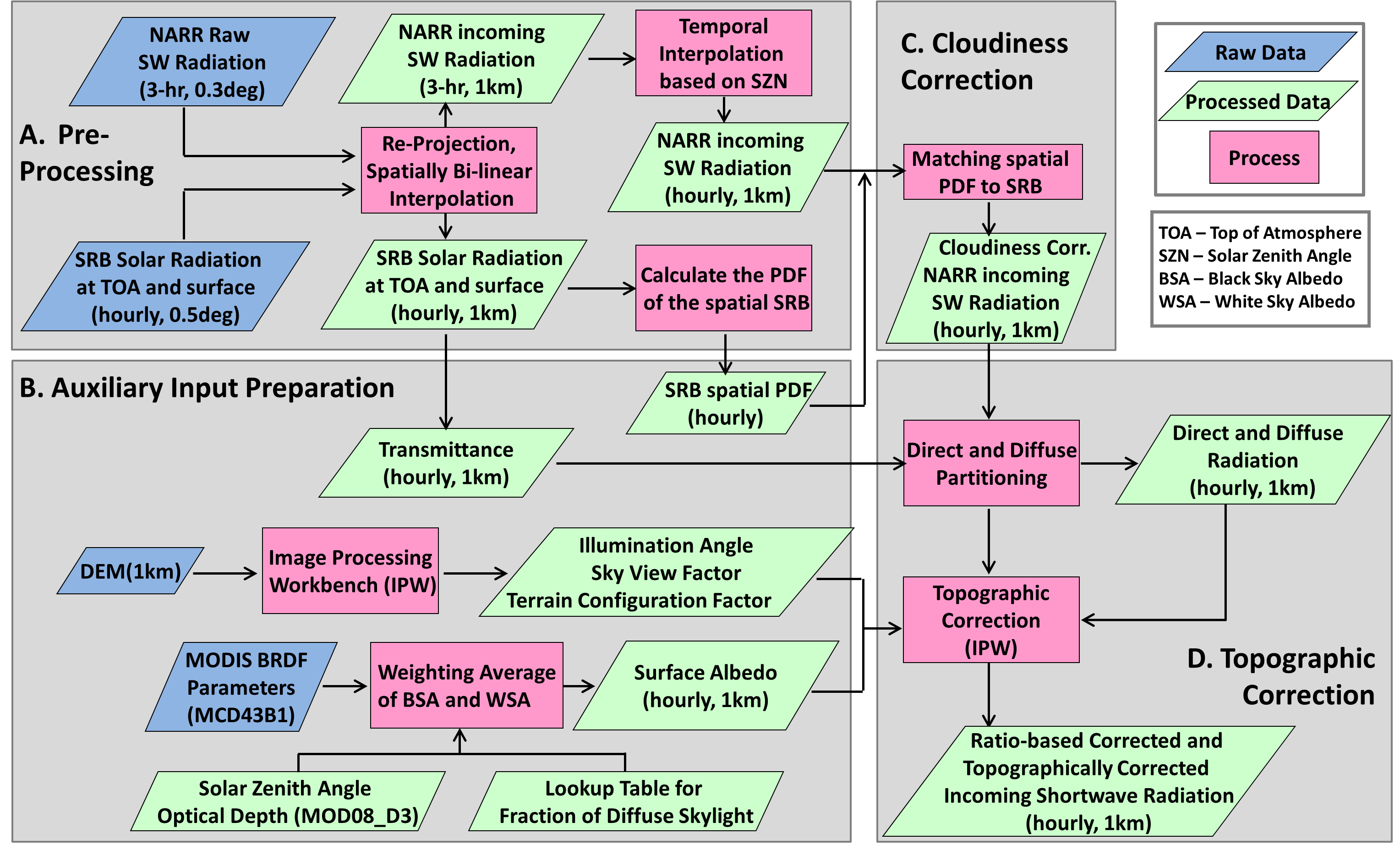
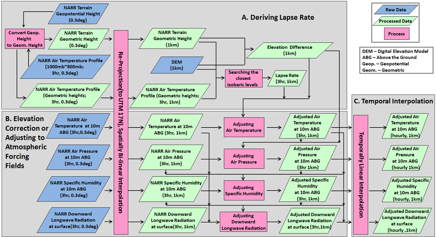
The atmospheric forcing data are extracted from the North American Regional Reanalysis (NARR) products originally at 32-km spatial resolution and 3-hour temporal resolution. Atmospheric forcing datasets include air temperature, air pressure, specific humidity, wind velocity at 10m above ground, and downward shortwave and longwave radiation at surface. Elevation adjustments and corrections to near-surface variables are applied between NARR envelope terrain and local terrain at every time-step based on predicted atmospheric conditions (e.g. using dynamic lapse rates). Special bias corrections for downward shortwave radiation are applied through dynamical adjustment, accounting for localized elevation and topographic effects. The temporal interpolation for shortwave radiation is integrated in the topographic correction to capture the local diurnal solar cycle based on solar zenith angle.
Table - Summary of the Atmospheric Forcing Datasets
Data Source | Input Fields | Variable Name | SIZE | FORMAT | Unit |
NARR | Specific humidity at 10m ABG | SpecHumi_10m.bin | N×M×T | BIN | kg/kg |
Air temperature at 10m ABG | AirTemp_10m.bin | N×M×T | BIN | K | |
Air pressure at 10m ABG | AirPressure_10m.bin | N×M×T | BIN | mb | |
Wind velocity at 10m ABG | WindSpeed_10m.bin | N×M×T | BIN | m/s | |
Incoming longwave radiation at surface | DLWR_surf.bin | N×M×T | BIN | W/m 2 | |
Incoming shortwave radiation at surface | DSWR_surf.bin | N×M×T | BIN | W/m 2 |
Elevation Correction to Air Temperature, Air Pressure, Specific Humidity at 10m above ground, and Downward Longwave Radiation
Topographic Correction to Downward Shortwave Radiation at surface