To access these data, click on the DOI: 10.7924/G8H41PBG
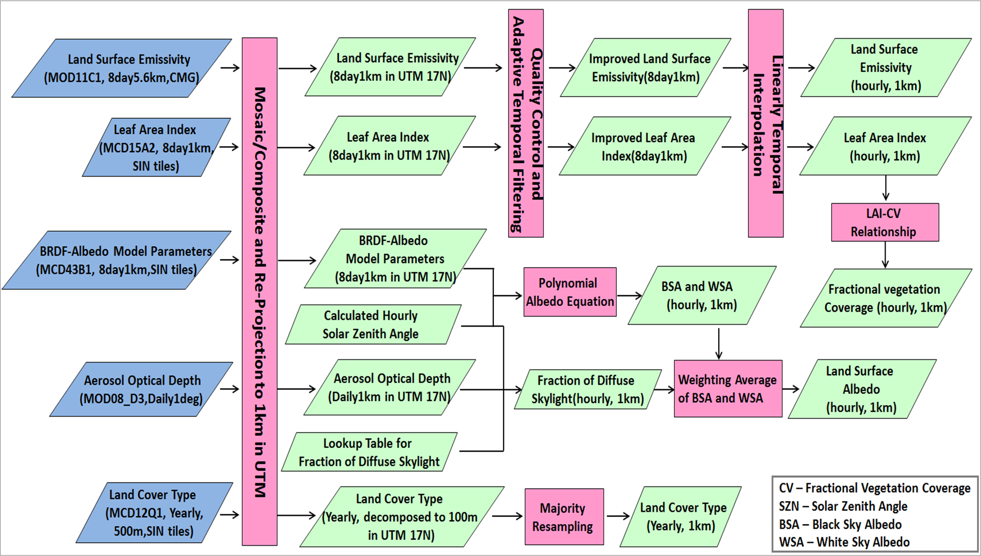
Space-time varying land surface properties such as broadband albedo, broadband emissivity, fractional vegetation coverage, and leaf area index were derived from the Moderate Resolution Imaging Spectroradiometer (MODIS) products. Generally, the original products are re-projected and composited to the study area, bi-linearly interpolated to basin grids, and then linearly interpolated into hourly time steps. Quality-control and temporal filtering for the landscape attributes data are performed to reduce the discontinuity caused by cloud contamination.
Table - Summary of Landscape Attributes Datasets
| Data Source | Input Fields | Variable Name | SIZE | FORMAT | Unit |
MODIS | Land Surface Albedo | Albedo.bin | N×M×T | BIN | - |
| Land Surface Emissivity | Emissivity.bin | N×M×T | BIN | - | |
| Fractional vegetation coverage | CV.bin | N×M×T | BIN | - | |
| Leaf area index | LAI.bin | N×M×T | BIN | - |
Image

